We flew from Auckland to Christchurch in order to get ourselves onto the South Island. This leg of our trip allowed us to
see the natural beauty of New Zealand, which did not disappoint. Here we are in the Southern Alps.
According to Wikipedia, the Southern Alps were formed by tectonic uplifting and pressure as the Pacific and Indo-Australian Plates
collided along the island's western coast. The uplifting continues,
raising Aoraki/Mount Cook an average of 7 millimeters (.28 inches) each
year. However, erosive forces are also shaping the
mountains. The severe weather is due to the mountains jutting into
powerful westerly winds,
which run around approximately 45°S latitude, south of both Africa and
Australia.
Here are some fascinating views of the South Island's "white rivers" from the air and on the ground.
We drove in New Zealand's rural lands, which were much different from the Australian desert where there was red soil, hardly any cars, not much vegetation, and flat land with straight roads went on for miles and miles. New Zealand's South Island features many different shades of green with blue mountains in the distance. The road twists and turns and goes up and down. There are lots of things to look at: plants, trees, rocks, hills, livestock, forests, lakes, lush rivers, dried up rivers with exposed white stones bleached from the sun, and best of all: mountains. We saw Mt. Cook that has a beautiful ice-blue lake in its foreground. Stunning!! It looks just like the National Geographic.
The air is pleasant, fresh, and clean. And even though it is summer, it's not stifling hot like the Australian Outback. Rather it's moderate, probably in the low 80s or high 70s. The evening provided a cool freshness so I left the sliding door of my room open to capture the natural air rather than run the air conditioner. I also watched for the sunset on the clear sky and looked for stars and planets. Unfortunately, I did not find the Southern Cross, a constellation only visible in the Southern Hemisphere.
New Zealand is a beautiful country, and I enjoyed it immediately. There's a peace and calm here that I didn't get in Australia--and certainly not in France or the USA. Internationally, NZ is a new country and one of the safest in the world. Our bus driver from NZ said that he lived in Australia for 19 years before he decided to return to his home country of NZ--and he's been glad about his decision ever since.
Apparently, people don't feel isolated on these islands. In fact, they like being far away from the rest of the world. Flying from Auckland to Christchurch revealed that there is not much settlement here but a lot of mountains--high mountains. There are only 5 million people, but they seem to excel in the things they do. Perhaps NZ is an unassuming country because it is so far away from every0ne else. Nevertheless, the peace and calm here feels good. Maybe the prevalence of Nature influences that ambiance. I recall that my father-in-law loved NZ and said he'd like to move here once the hideous Iraq War began in 2003. Get away from it all. And yet, I'm finding that there's a "hipness" here enough to meet today's expected standards of Western culture--like something you would find in California--only without the effort of trying to look hip. People just seem to live in a laid-back sort of way, again, not trying too hard to achieve it.

The mountains in this area are still growing at an astounding rate of about .28 inches per year. New Zealand is the youngest land mass on Earth.
Twizel
After
flying into Christchurch from Auckland, we headed for our overnight
destination: a town called Twizel (pronounced with a long I).
We stayed overnight in the Mackenzie Country Hotel, which reminded me of the knotty pine lodges in Michigan's Up North regions in the 1960s. The dining room had a fireplace decorated with heads of rams instead of deer. Keys to the doors of each room were real keys, and the windows and sliding doors opened! The hearty dinner and breakfast buffets were out of this world with a wide variety of hot and cold foods. A rack of postcards offered visitors scenes of the area--including one of the night sky, which depicted the Southern Cross constellation.


My room with 1960s amenities. Loved it!!


The daylight and sunset views from my room were breath-taking! Not bad for a town with a funny name. 
On the second day, we rode the bus from Twizel to Queenstown, our next overnight. That's when we began to see the majestic mountains, rivers, and lakes. Our drivers were very generous in taking time to show them to us.
Aoraki/Mt. Cook is the highest mountain in the area, named after Captain James Cook, the British explorer who circumnavigated the islands of New Zealand in 1770.
Captain Cook never saw the mountain during his exploration, however. The first Europeans who may have seen Aoraki/Mt. Cook were members of Abel Tasman's
crew while they anchored off the west coast of the South Island on December 13, 1642 during Tasman's first Pacific voyage.
What must it have been like seeing this land with Western eyes for the first time? Notably, the area is still pretty much uninhabited and untouched. Of the 5 million people who live in New Zealand only 40% of them live on the South Island.
Aoraki/Mount Cook towers 12,218 feet in the Southern Alps, which run the entire length of the South Island. This popular tourist destination is also a favorite challenge for mountain climbers.
The Māori came here after their arrival to New Zealand some time during the 14th century. Consequently, after the settlement
between Ngāi Tahu and the British Crown in 1998, a number of South Island place
names incorporated their Māori names by the Ngāi Tahu Claims Settlement Act 1998. The name of the mountain was officially changed from Mount Cook to Aoraki/Mount Cook as a result. Under the settlement, the Crown also agreed to return title of Aoraki/Mount Cook to Ngāi Tahu, who would then formally gift it back to the
nation.
Mackenzie Basin

Three pristine lakes comprise the Mackenzie Basin: Lake Tekapo, Lake Pukaki, and Lake Ohau. Lake Tekapo is pictured here.
On the lake is the Church of the Good Shepherd, which
was built first to the glory of God and secondly as a memorial to the
pioneers of the district.
 This modest stone church was designed to give
the impression of quiet strength and simplicity, which embodied the
essential qualities of the early settlers who endured the tough
Mackenzie environment. The explanations about the church were written in English and Maori,
NZ's two official languages. Braille is the country's third official language.
This modest stone church was designed to give
the impression of quiet strength and simplicity, which embodied the
essential qualities of the early settlers who endured the tough
Mackenzie environment. The explanations about the church were written in English and Maori,
NZ's two official languages. Braille is the country's third official language.To get to the church, we crossed this footbridge. It seemed like an ordinary thing to do until I looked up the
bridge's history, which "spans" 62 years from conception to completion.
Once a wooden bridge, many attempts had been made to construct a more solid bridge since 1953. But it was not until September 2009 that Colin Maclaren, architect and resident of Lake Tekapo, organized a committee to build the present-day bridge, which opened in early 2017. It measures 410 feet in length with 167 feet of unsupported span and 42.65 feet high to protect it from the river's floods. The bridge's original cost estimate was $1 million but as time went by and more steel bracing was deemed necessary to protect it from earthquakes, high winds, and snow, the cost escalated to $2.3 million. The piers were constructed by a local stonemason during the summer 2012-13 and dug deep into the riverbed. They stood as sentinels awaiting the steel bridge, which was constructed in Christchurch and then transported in 7 sections to this site in October 2015.

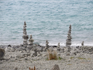
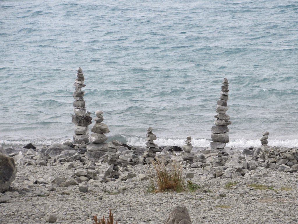
People felt compelled to make cairn stones on the shore near the church. Blinky, our guide, said that this is not an environmentally-sound thing to do because it changes the shoreline in an unnatural way. On the left is another view of Lake Tekapo.
Lake Pukaki
Lake Pukaki is the largest of three roughly alpine lakes here in the Mackenzie Basin. I was quite taken with the blue water and snow-capped mountains, as these photos show. They surely fulfilled my image of New Zealand!
The
three lakes of the Mackenzie Basin were formed when the terminal moraines of receding glaciers
blocked their respective valleys and formed moraine-dammed lakes. Their
distinctive blue color is created by the tiny, silt-like particles that
run off the glacial feed into the lakes. These particles, called
"glacial flour", were ground by the glaciers. Then they float in the
melt water. When
the sediments enter a river, they turn the river's color
into grey, light brown, iridescent blue-green, or milky white. If the
river
flows into a glacial lake, as it does with Lake Pukaki,
the lake appears turquoise. Lake Pukaki covers an area of 111 square
miles, and the surface elevation of
the lake normally ranges from 1700 to 1745 feet above sea level.
Other Mountain Scenes on the Road to Queenstown

Cromwell
We stopped in Cromwell for about an hour. This little town was established in 1863 during the Otago gold rush and is now known as one of the sub-regions of the Central Otago wine region. The 45th parallel south runs just north of the township. The town was named after Oliver Cromwell but was previously known as "The Junction" (due to the confluence of the Clutha/Mata-Au River and the Kawarau River), "The Point", and "Kawarau".
European explorers came to the area in September 1853. Further explorations occurred in the late 1850s with
detailed surveys made in 1861. In 1862, gold was discovered by two miners: Horatio Hartley and Christopher Reilly.
Once word of a gold strike was out, an influx of several
thousand miners came to the area and nine hotels opened in
Cromwell to accommodate them.
 When the gold ran out, Cromwell became the service center for an extensive farming and stone fruit
growing area. An irrigation scheme was built in the 1920s diverting
water from the Kawarau river to irrigate a large area of land near
Ripponvale.
When the gold ran out, Cromwell became the service center for an extensive farming and stone fruit
growing area. An irrigation scheme was built in the 1920s diverting
water from the Kawarau river to irrigate a large area of land near
Ripponvale.
Today, Cromwell is nicknamed the "Fruit Bowl of the South". This giant sculpture
of stone fruit was built by the Cromwell Rotary Club in 1990.

When
the road between Clyde and Cromwell was completed in 1864, Cobb &
Co. started running its coach service to Cromwell. By 1867 they were
running three trips per week between Dunedin and Queenstown via
Cromwell.
The Cromwell railway station, which connected Cromwell to Dunedin, opened in July 1921. It burnt down in 1942 and
was subsequently rebuilt. It finally closed in 1976 with a railway line
from Clyde to Cromwell, which then closed in 1980.

In
1869, The Post & Telegraph Office was opened in a small wooden hut
with the mail coming from Dunedin by coach or wagon. A more substantial
building was erected and opened in 1871and a telephone exchange opened
in 1910 with nine subscribers.


The
Cromwell Argus newspaper was established in 1869 and closed on October 12, 1948 when it was purchased by the Central
Otago News.
The decision to build Clyde Dam
and use Cromwell as the accommodation base brought many changes to the
town including the doubling of the residential area, relocation
of the old town centre (now called "Old Cromwell Town"). Several of the old buildings of the town which escaped the flooding
have been retained as the Historic Precinct close to the shore of the
Kawarau.
The construction of the Clyde Dam created Lake Dunstan (right), which consumed
part of the old Cromwell. Some of the historic buildings were
saved or rebuilt to create the Heritage Precinct, which is pictured below. The lake started to fill in during autumn 1992 and 2000 hectares were flooded by Lake Dunstan. That
included farmland and 17 orchards.


By
early 1871, the population of Cromwell was 497. Gold mining was replaced by dredging companies
in the 1890s. but was short lived.
The population decreased with smaller scale mining activities
continuing until the 1930s. By 1971, 988 people called Cromwell home. The 2018 census noted a population of 5,610.
Pork Belly Lunch at the Central Otago Winery
 We
stopped for a lunch of pork belly sandwiches, potatoes, and a little wine tasting in the Central Otago Wine Region.
We
stopped for a lunch of pork belly sandwiches, potatoes, and a little wine tasting in the Central Otago Wine Region.

For flavoring, they grill the pork belly on top of wine casks filled with water.

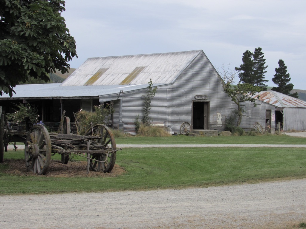
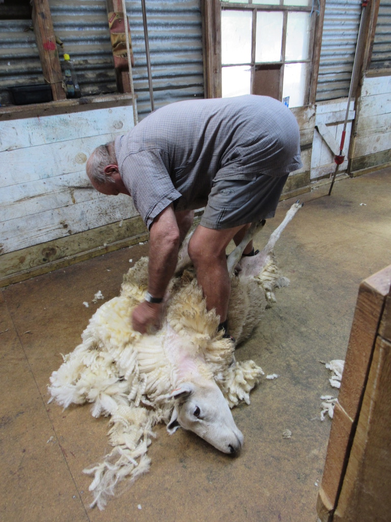
After lunch, we went to the sheep station (see blog) to see how sheep are sheared. In the late afternoon we arrived in Queenstown where we stayed for three nights.
Resources
https://en.wikipedia.org/wiki/Jackaroo
https://www.stats.govt.nz/indicators/livestock-numbers
https://www.raisingsheep.net/how-many-sheep-are-in-new-zealand
https://www.statista.com/statistics/974492/new-zealand-sheep-livestock-numbers/
https://en.wikipedia.org/wiki/Aoraki_/_Mount_Cook
https://en.wikipedia.org/wiki/Cromwell,_New_Zealand
https://en.wikipedia.org/wiki/Clyde_Dam


 Jackaroo in training. A
jackaroo is a young man working on a
sheep or cattle station, who gains practical experience in the skills
needed to become an owner, overseer, manager, etc. The oldest son on the
station is starting out his career by learning how to drive the
equipment.
Jackaroo in training. A
jackaroo is a young man working on a
sheep or cattle station, who gains practical experience in the skills
needed to become an owner, overseer, manager, etc. The oldest son on the
station is starting out his career by learning how to drive the
equipment.